
Local: 801-537-3320 Toll Free: 888-UTAHMAP (882-4627)
Hours: Monday–Friday 9 a.m. to 5 p.m.
Closed for State of Utah holidays

-
-
- Recreation Books
- Adventure and Survival Books
- Hiking Books
- Outdoor Activities
- Fishing Maps & Books
- Rock Art and Scenic Books
- Nature Guide
-
Rockhounding, Geology and Mining
- Rockhounding, Geology and Mining
- Dinosaur and Fossil Books
- Geology Books
- Mineral Books
- Identification Field Guides
- Rockhounding Books
- Prospecting Books
- Mining Books
-
Navigation, First Aid and Knots
- Navigation, First Aid and Knots
- Knots Books
- First Aid Books
- Navigation Books
- Astronomy and Weather Books
-
- Geologic Publications
-
Economic Geology
- Economic Geology
- Engineering
- Minerals and Mining
- Uranium and Vanadium
- Coal Resources
- Fossil Energy
-
Minerals and Mining
- Minerals and Mining
- Gold
- Rocks, Minerals, and Fossils
- Mining
- Geologic Hazards
- Geothermal
- Great Salt Lake and Antelope Island
- Quaternary Studies and General Geology
- Paleontology and Paleoecology
- Stratigraphic Studies
- Water
- Public Interests
- Utah Geological Association
-
- Featured Maps and Books
- Exploring Southern Utah
- Utah Geological Survey - Survey Notes
-
- Deals
- Dino Deals
- Survival Books
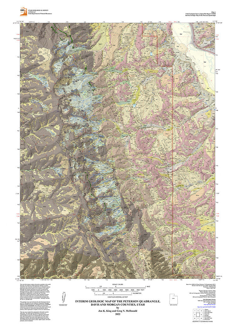
Interim Geologic Map of the Peterson Quadrangle, Davis and Morgan Counties, Utah (OFR-734dm)
SKU:
95437019
Availability:
Out Of Stock
Product type:
Utah Geological Survey Map
- $16.95
- $16.95
- Unit price
- / per
Subtotal:
$16.95
🖨️ Out of physical stock — Available via Print on Demand
This item will be printed upon order and ships in 3-5 business days.
Description
xBy: Jon K. King, Greg N. McDonald
The Peterson quadrangle is located southeast of Ogden, Utah. The major geographic features in and near the map area are Morgan Valley, the northern Wasatch Range to the west, Durst Mountain to the east, the Weber River in Morgan Valley, and lower Weber Canyon cut into the Wasatch Range by the river. Plate 2 includes the map explanation showing, map units, unit correlations, geologic symbols, a lithologic column, and cross section. A separate booklet contains geologic unit descriptions, references, and tables.
Other Information:
Published: 2022Pages: 27
Plates: 2
Scale: 1:24,000
Includes GIS data
Location: Utah
Media Type: Paper Map
Related Products
Example product title
- $16.95
- $16.95
- Unit price
- / per
Example product title
- $16.95
- $16.95
- Unit price
- / per
Example product title
- $16.95
- $16.95
- Unit price
- / per
Example product title
- $16.95
- $16.95
- Unit price
- / per
Example product title
- $16.95
- $16.95
- Unit price
- / per
Example product title
- $16.95
- $16.95
- Unit price
- / per
Example product title
- $16.95
- $16.95
- Unit price
- / per
Example product title
- $16.95
- $16.95
- Unit price
- / per
Example product title
- $16.95
- $16.95
- Unit price
- / per
Example product title
- $16.95
- $16.95
- Unit price
- / per
Recently Viewed Products
Example product title
- $16.95
- $16.95
- Unit price
- / per
Example product title
- $16.95
- $16.95
- Unit price
- / per
Example product title
- $16.95
- $16.95
- Unit price
- / per
Example product title
- $16.95
- $16.95
- Unit price
- / per
Example product title
- $16.95
- $16.95
- Unit price
- / per
Example product title
- $16.95
- $16.95
- Unit price
- / per
Example product title
- $16.95
- $16.95
- Unit price
- / per
Example product title
- $16.95
- $16.95
- Unit price
- / per
Example product title
- $16.95
- $16.95
- Unit price
- / per
Example product title
- $16.95
- $16.95
- Unit price
- / per
- Choosing a selection results in a full page refresh.