
Local: 801-537-3320 Toll Free: 888-UTAHMAP (882-4627)
Hours: Monday–Friday 9 a.m. to 5 p.m.
Closed for State of Utah holidays

-
-
- Recreation Books
- Adventure and Survival Books
- Hiking Books
- Outdoor Activities
- Fishing Maps & Books
- Rock Art and Scenic Books
- Nature Guide
-
Rockhounding, Geology and Mining
- Rockhounding, Geology and Mining
- Dinosaur and Fossil Books
- Geology Books
- Mineral Books
- Identification Field Guides
- Rockhounding Books
- Prospecting Books
- Mining Books
-
Navigation, First Aid and Knots
- Navigation, First Aid and Knots
- Knots Books
- First Aid Books
- Navigation Books
- Astronomy and Weather Books
-
- Geologic Publications
-
Economic Geology
- Economic Geology
- Engineering
- Minerals and Mining
- Uranium and Vanadium
- Coal Resources
- Fossil Energy
-
Minerals and Mining
- Minerals and Mining
- Gold
- Rocks, Minerals, and Fossils
- Mining
- Geologic Hazards
- Geothermal
- Great Salt Lake and Antelope Island
- Quaternary Studies and General Geology
- Paleontology and Paleoecology
- Stratigraphic Studies
- Water
- Public Interests
- Utah Geological Association
-
- Featured Maps and Books
- Exploring Southern Utah
- Utah Geological Survey - Survey Notes
-
- Deals
- Dino Deals
- Survival Books
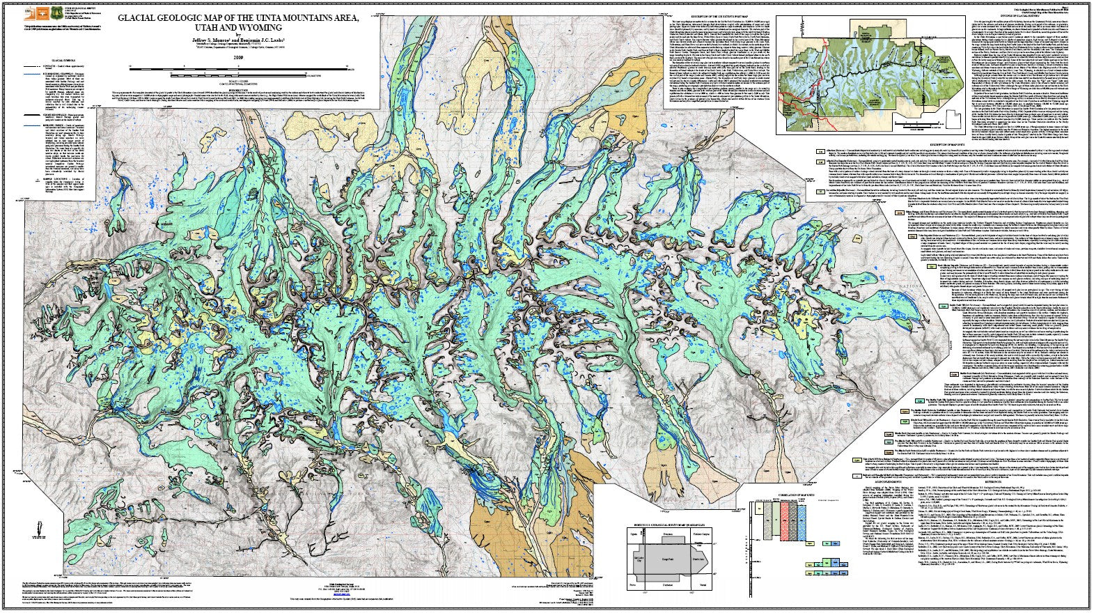
Glacial geologic map of the Uinta Mountains area, Utah and Wyoming (MP 09-4dm)
SKU:
00653365
Availability:
Many In Stock
Product type:
Utah Geological Survey Miscellaneous Publication
- $35.00
- $35.00
- Unit price
- / per
Subtotal:
$35.00
Description
xBy: J. S. Munroe and B. J. C. Laabs
This dataset represents the first complete inventory of the glacial deposits in the Uinta Mountains since Atwood (1909) described the glacial geology of this area. It is the result of previous and continuing work by the authors and others to better understand the glacial and climatic history of this fascinating area. It depicts the distribution of glacial deposits and post-glacial sediments including mass wasting, lacustrine, and rock glacier deposits. A discussion of the glacial history and a figure showing a reconstruction of the ice extent during the local Last Glacial Maximum are also included.
Other Information:
Published: 2009
Plates: 1 pl.
Scale: 1:100,000
Location: Daggett County, Duchesne County, Summit County, Uintah County, and Wasatch County
Media Type: Polypropylene Map
Related Products
Example product title
- $35.00
- $35.00
- Unit price
- / per
Example product title
- $35.00
- $35.00
- Unit price
- / per
Example product title
- $35.00
- $35.00
- Unit price
- / per
Example product title
- $35.00
- $35.00
- Unit price
- / per
Example product title
- $35.00
- $35.00
- Unit price
- / per
Example product title
- $35.00
- $35.00
- Unit price
- / per
Example product title
- $35.00
- $35.00
- Unit price
- / per
Example product title
- $35.00
- $35.00
- Unit price
- / per
Example product title
- $35.00
- $35.00
- Unit price
- / per
Example product title
- $35.00
- $35.00
- Unit price
- / per
Recently Viewed Products
Example product title
- $35.00
- $35.00
- Unit price
- / per
Example product title
- $35.00
- $35.00
- Unit price
- / per
Example product title
- $35.00
- $35.00
- Unit price
- / per
Example product title
- $35.00
- $35.00
- Unit price
- / per
Example product title
- $35.00
- $35.00
- Unit price
- / per
Example product title
- $35.00
- $35.00
- Unit price
- / per
Example product title
- $35.00
- $35.00
- Unit price
- / per
Example product title
- $35.00
- $35.00
- Unit price
- / per
Example product title
- $35.00
- $35.00
- Unit price
- / per
Example product title
- $35.00
- $35.00
- Unit price
- / per
- Choosing a selection results in a full page refresh.