
Local: 801-537-3320 Toll Free: 888-UTAHMAP (882-4627)
Hours: Monday–Friday 9 a.m. to 5 p.m.
Closed for State of Utah holidays

-
-
- Recreation Books
- Adventure and Survival Books
- Hiking Books
- Outdoor Activities
- Fishing Maps & Books
- Rock Art and Scenic Books
- Nature Guide
-
Rockhounding, Geology and Mining
- Rockhounding, Geology and Mining
- Dinosaur and Fossil Books
- Geology Books
- Mineral Books
- Identification Field Guides
- Rockhounding Books
- Prospecting Books
- Mining Books
-
Navigation, First Aid and Knots
- Navigation, First Aid and Knots
- Knots Books
- First Aid Books
- Navigation Books
- Astronomy and Weather Books
-
- Geologic Publications
-
Economic Geology
- Economic Geology
- Engineering
- Minerals and Mining
- Uranium and Vanadium
- Coal Resources
- Fossil Energy
-
Minerals and Mining
- Minerals and Mining
- Gold
- Rocks, Minerals, and Fossils
- Mining
- Geologic Hazards
- Geothermal
- Great Salt Lake and Antelope Island
- Quaternary Studies and General Geology
- Paleontology and Paleoecology
- Stratigraphic Studies
- Water
- Public Interests
- Utah Geological Association
-
- Featured Maps and Books
- Exploring Southern Utah
- Utah Geological Survey - Survey Notes
-
- Deals
- Dino Deals
- Survival Books
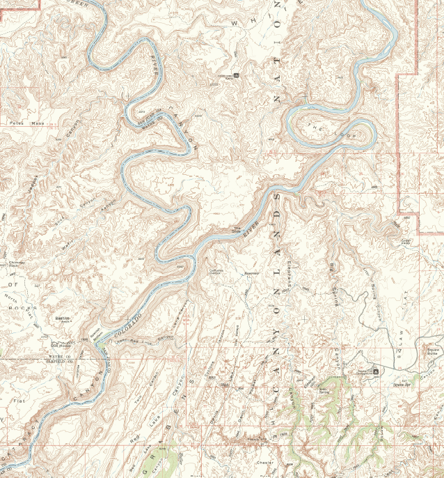

Canyonlands National Park & Vicinity Map, 1968
SKU:
M-63KCanyonlands-1
Availability:
Many In Stock
Product type:
1:62,500 Topographic Map
- $20.00
- $20.00
- Unit price
- / per
Subtotal:
$20.00
Description
xThe distinctive characteristic of a topographic map is that the shape of the Earth's surface is shown by contour lines. Contours are imaginary lines that join points of equal elevation on the surface of the land above or below a reference surface, such as mean sea level. Contours make it possible to measure the height of mountains, depths of the ocean bottom, and steepness of slopes. A topographic map shows more than contours. The map also includes symbols that represent such features as streets, buildings, streams, and vegetation.
Other Information:
Published: 1968
Scale: 1:62,500
Media Type: Paper Map
Location: Canyonlands National Park, UT
Related Products
Example product title
- from $20.00
- from $20.00
- Unit price
- / per
Example product title
- from $20.00
- from $20.00
- Unit price
- / per
Example product title
- from $20.00
- from $20.00
- Unit price
- / per
Example product title
- from $20.00
- from $20.00
- Unit price
- / per
Example product title
- from $20.00
- from $20.00
- Unit price
- / per
Example product title
- from $20.00
- from $20.00
- Unit price
- / per
Example product title
- from $20.00
- from $20.00
- Unit price
- / per
Example product title
- from $20.00
- from $20.00
- Unit price
- / per
Example product title
- from $20.00
- from $20.00
- Unit price
- / per
Example product title
- from $20.00
- from $20.00
- Unit price
- / per
Recently Viewed Products
Example product title
- from $20.00
- from $20.00
- Unit price
- / per
Example product title
- from $20.00
- from $20.00
- Unit price
- / per
Example product title
- from $20.00
- from $20.00
- Unit price
- / per
Example product title
- from $20.00
- from $20.00
- Unit price
- / per
Example product title
- from $20.00
- from $20.00
- Unit price
- / per
Example product title
- from $20.00
- from $20.00
- Unit price
- / per
Example product title
- from $20.00
- from $20.00
- Unit price
- / per
Example product title
- from $20.00
- from $20.00
- Unit price
- / per
Example product title
- from $20.00
- from $20.00
- Unit price
- / per
Example product title
- from $20.00
- from $20.00
- Unit price
- / per
- Choosing a selection results in a full page refresh.