
Local: 801-537-3320 Toll Free: 888-UTAHMAP (882-4627)
Hours: Monday–Friday 9 a.m. to 5 p.m.
Closed for State of Utah holidays

-
-
- Recreation Books
- Adventure and Survival Books
- Hiking Books
- Outdoor Activities
- Fishing Maps & Books
- Rock Art and Scenic Books
- Nature Guide
-
Rockhounding, Geology and Mining
- Rockhounding, Geology and Mining
- Dinosaur and Fossil Books
- Geology Books
- Mineral Books
- Identification Field Guides
- Rockhounding Books
- Prospecting Books
- Mining Books
-
Navigation, First Aid and Knots
- Navigation, First Aid and Knots
- Knots Books
- First Aid Books
- Navigation Books
- Astronomy and Weather Books
-
- Geologic Publications
-
Economic Geology
- Economic Geology
- Engineering
- Minerals and Mining
- Uranium and Vanadium
- Coal Resources
- Fossil Energy
-
Minerals and Mining
- Minerals and Mining
- Gold
- Rocks, Minerals, and Fossils
- Mining
- Geologic Hazards
- Geothermal
- Great Salt Lake and Antelope Island
- Quaternary Studies and General Geology
- Paleontology and Paleoecology
- Stratigraphic Studies
- Water
- Public Interests
- Utah Geological Association
-
- Featured Maps and Books
- Exploring Southern Utah
- Utah Geological Survey - Survey Notes
-
- Deals
- Dino Deals
- Survival Books
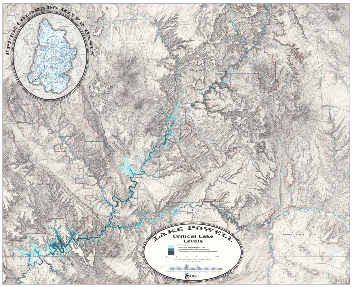
Lake Powell Critical Levels Wall Map
SKU:
Availability:
Many In Stock
Product type:
Utah Wall Maps
- $20.00
- $20.00
- Unit price
- / per
Subtotal:
$20.00
Description
xAfter more than 20 years of drought and a historic record low snowpack in 2026, Lake Powell is fast approaching its lowest recorded level of 3,525 feet, set in July 2021. If the water continues to drop, the dam will lose its ability to generate power once levels fall below the turbine intakes at 3,490 feet. Should the reservoir drop even further, Lake Powell risks becoming a 'dead pool' at 3,370 feet, where no water is able to pass through the dam to the Grand Canyon and states downstream. This award-winning map from the Utah Geospatial Resource Center (UGRC) depicts the historic high-water mark of 1983 along with the critical low levels facing the reservoir today. Using data from the State Geographic Information Database (SGID) and the USGS, it also includes the previously drowned rapids on the Colorado and San Juan Rivers that are re-emerging as the reservoir shrinks and lake sediment erodes.
Other Information:
Size: Approximately 36" x 44"
Related Products
Example product title
- from $20.00
- from $20.00
- Unit price
- / per
Example product title
- from $20.00
- from $20.00
- Unit price
- / per
Example product title
- from $20.00
- from $20.00
- Unit price
- / per
Example product title
- from $20.00
- from $20.00
- Unit price
- / per
Example product title
- from $20.00
- from $20.00
- Unit price
- / per
Example product title
- from $20.00
- from $20.00
- Unit price
- / per
Example product title
- from $20.00
- from $20.00
- Unit price
- / per
Example product title
- from $20.00
- from $20.00
- Unit price
- / per
Example product title
- from $20.00
- from $20.00
- Unit price
- / per
Example product title
- from $20.00
- from $20.00
- Unit price
- / per
Recently Viewed Products
Example product title
- from $20.00
- from $20.00
- Unit price
- / per
Example product title
- from $20.00
- from $20.00
- Unit price
- / per
Example product title
- from $20.00
- from $20.00
- Unit price
- / per
Example product title
- from $20.00
- from $20.00
- Unit price
- / per
Example product title
- from $20.00
- from $20.00
- Unit price
- / per
Example product title
- from $20.00
- from $20.00
- Unit price
- / per
Example product title
- from $20.00
- from $20.00
- Unit price
- / per
Example product title
- from $20.00
- from $20.00
- Unit price
- / per
Example product title
- from $20.00
- from $20.00
- Unit price
- / per
Example product title
- from $20.00
- from $20.00
- Unit price
- / per
- Choosing a selection results in a full page refresh.