-
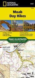
Moab Day Hikes (TI-1718)The Moab Day Hikes contains detailed maps for 18 of Moab's finest day hikes. It includes well-known hikes and some off-the-beaten-path trails. They range from easy strolls to strenuous climbs, selected to give you a sampling of all the region has to offer. Together, they cover...
- $14.95
- $14.95
- Unit price
- per
-
Black Rock, Great Salt Lake Vintage PostcardPostcards from the Past. Discover a bygone era with this captivating historical postcard, "Black Rock, Great Salt Lake," a window into Utah's picturesque past. This isn't just a postcard; it's a tangible piece of history, produced between 1910 and 1930, transporting you to a...
- $1.00
- $1.00
- Unit price
- per
-
Earthquake fault map of a portion of Washington County, Utah (PI-85)By: UGS Staff This map shows the location of faults in the Hurricane fault zone adjacent to the towns of La Verkin and Hurricane and in the Washington fault zone adjacent to St. George and Washington. Back side of map includes information on faults,...
- $0.00
- $0.00
- Unit price
- per
-
Liquefaction-potential map for a part of Davis County, Utah (PI-24)By: J. L. Jarva The liquefaction-potential categories of Davis County are mapped based on local geology and subsurface soil and water conditions and depend on the probability of having an earthquake within a 100-year period that will be strong enough to cause liquefaction in...
- $0.05
- $0.05
- Unit price
- per
-
Nine Miracles: When Bullets Can't Kill and Hope PrevailsFor fans of survival memoirs comes a compelling memoir of surviving the unthinkable and emerging with a powerful story in resilience.Lessons about embracing the miracles of life, based on a story of how Brody Young survived being shot nine times and severely wounded by...
- $28.99
- $28.99
- Unit price
- per
-
The Hour of Land: A Personal Topography of America's National ParksAn ode to our national parks, timed for the centennial, by the beloved author of When Women Were BirdsLonglisted for an Andrew Carnegie Medal for ExcellenceA Washington Post Notable Book of the YearAmerica’s national parks are breathing spaces in a world in which such spaces are steadily...
- $21.00
- $21.00
- Unit price
- per
-
STONE DESERTOriginally published over twenty-five years ago, Stone Desert brings the wonder and wildness of one of our nation’s most geologically and culturally unique national parks to readers everywhere. With a new introduction by the author, this edition includes Craig Childs’s original journal—written over a winter in...
- $21.95
- $21.95
- Unit price
- per
-
Glacier Bay National Park and Preserve (TI-255)National Geographic's Trails Illustrated map of Glacier Bay National Park and Preserve in Alaska's panhandle is perfect for hiking, camping, boating, paddling, and wildlife viewing in this scenic, rugged frontier. Created in partnership with local land management agencies, this expertly researched map delivers unmatched...
- $14.95
- $14.95
- Unit price
- per
-
Denali National Park (TI-222)National Geographic's Trails Illustrated map of Denali National Park provides an unparalleled tool for exploring this remarkable region. Denali National Park and Preserve covers a staggering six million acres of truly wild and pristine wilderness, bisected by a single road. The crown jewel of...
- $14.95
- $14.95
- Unit price
- per
-
National Parks of the United States MapNational Geographic’s Destination Map of National Parks of the United States highlights the nearly 400 magnificent parks across America. The country is represented in subtle earth-tones with shaded mountain relief and intricately drawn river systems. Photos capture some of the diverse landscapes preserved and...
- $14.95
- $14.95
- Unit price
- per
-
Liquefaction potential map for Cache Valley, Cache County, Utah (PI-79)By: UGS Staff The liquefaction-potential categories of Cache Valley are mapped based on local geology and subsurface soil and water conditions and depend on the probability of having an earthquake within a 100-year period that will be strong enough to cause liquefaction in those...
- $0.05
- $0.05
- Unit price
- per
-
Geologic resources of Summit County, Utah (PI-7)By: M. H. Bugden and C. M. Wilkerson This brochure will introduce the reader to Summit County's geologic resources and their effect on our economy and daily lives. Understanding the dynamic forces that form geologic resources and the factors influencing their development and use...
- $3.50
- $3.50
- Unit price
- per
-
Earthquakes & Utah (PI-48)By: S. N. Eldredge This pamphlet is an introduction to Utah’s earthquakes and answers the commonly asked questions of where, why, and how often earthquakes occur in Utah; how big they are and how they are measured; and what may happen during an earthquake....
- $0.05
- $0.05
- Unit price
- per
-
Liquefaction-potential map for a part of Weber County, Utah (PI-27)By: J. L. Jarva The liquefaction-potential categories of Weber County are mapped based on local geology and subsurface soil and water conditions and depend on the probability of having an earthquake within a 100-year period that will be strong enough to cause liquefaction in...
- $0.05
- $0.05
- Unit price
- per
-
Liquefaction-potential map for a part of Salt Lake County, UtahBy: J. L. Jarva The liquefaction-potential categories of Salt Lake County are mapped based on local geology and subsurface soil and water conditions and depend on the probability of having an earthquake within a 100-year period that will be strong enough to cause liquefaction...
- $0.05
- $0.05
- Unit price
- per
-
Earthquake fault map of a portion of Davis County, Utah (PI-2)By: UGS Staff This map shows the location of faults in Davis County. Back side of map includes information on faults, effects of surface fault rupture, when and where surface rupture is likely to occur, and what can be done to protect homes. Other...
- $0.00
- $0.00
- Unit price
- per
-
Geology and Grand County (MP-Q)By: H. H. Doelling and others Grand County is located in the heart of the Colorado Plateaus physiographic province, ranks 9th in land area with 3,692 square miles with a population of only 8241, 20th out of 29 Utah counties (1980 census). Perhaps more...
- $1.75
- $1.75
- Unit price
- per
-
Moon Arches & Canyonlands National Parks - Hiking, Biking, Scenic DrivesForge your own path through the rock arches, canyon-carving rivers, and ever-present ancient cultures of Southeastern Utah with Moon Arches & Canyonlands National Parks. Inside you’ll find: Flexible Itineraries: Unique and adventure-packed ideas for day trips to each park, road trips, and more The Best Hikes in Arches...
- $17.99
- $17.99
- Unit price
- per
-
Moon Utah: With Zion, Bryce Canyon, Arches, Capitol Reef & Canyonlands National ParksFrom remote deserts and arid mountain ranges to colorful canyons and world-famous national parks, Moon Utah reveals the best of this adventurous state. Inside you’ll find: Strategic itineraries, plus lists of the best scenic drives, hiking trails, breweries, and more How to plan a national parks road...
- $24.99
- $24.99
- Unit price
- per
-
Acadia National Park (TI-212)National Geographic's Trails Illustrated map of Acadia National Park is designed to meet the needs of all visitors who wish to explore the islands and bodies of water of this national park. Expertly researched and created in partnership with the National Park Service and...
- $14.95
- $14.95
- Unit price
- per

Local: 801-537-3320 Toll Free: 888-UTAHMAP (882-4627)
Hours: Monday–Friday 9 a.m. to 5 p.m.
-
-
- Recreation Books
- Adventure and Survival Books
- Hiking Books
- Outdoor Activities
- Fishing Maps & Books
- Rock Art and Scenic Books
- Nature Guide
-
Rockhounding, Geology and Mining
- Rockhounding, Geology and Mining
- Dinosaur and Fossil Books
- Geology Books
- Mineral Books
- Identification Field Guides
- Rockhounding Books
- Prospecting Books
- Mining Books
-
Navigation, First Aid and Knots
- Navigation, First Aid and Knots
- Knots Books
- First Aid Books
- Navigation Books
- Astronomy and Weather Books
-
- Geologic Publications
-
Economic Geology
- Economic Geology
- Engineering
- Minerals and Mining
- Uranium and Vanadium
- Coal Resources
- Fossil Energy
-
Minerals and Mining
- Minerals and Mining
- Gold
- Rocks, Minerals, and Fossils
- Mining
- Geologic Hazards
- Geothermal
- Great Salt Lake and Antelope Island
- Quaternary Studies and General Geology
- Paleontology and Paleoecology
- Stratigraphic Studies
- Water
- Public Interests
- Utah Geological Association
-
- Featured Maps and Books
- Exploring Southern Utah
- Utah Geological Survey - Survey Notes
-
- Deals
- Dino Deals
- Survival Books
Sidebar
Categories
- Maps
- Recreation Books
- Geologic Publications
- Discover More
- Featured Maps and Books
- Deals
Survey Notes


Recently Viewed Products
Example product title
- $19.99
- $19.99
- Unit price
- / per
Example product title
- $19.99
- $19.99
- Unit price
- / per
Example product title
- $19.99
- $19.99
- Unit price
- / per
Example product title
- $19.99
- $19.99
- Unit price
- / per
Example product title
- $19.99
- $19.99
- Unit price
- / per
Example product title
- $19.99
- $19.99
- Unit price
- / per
Example product title
- $19.99
- $19.99
- Unit price
- / per
Example product title
- $19.99
- $19.99
- Unit price
- / per
Example product title
- $19.99
- $19.99
- Unit price
- / per
Example product title
- $19.99
- $19.99
- Unit price
- / per
- Choosing a selection results in a full page refresh.