-
Panoramic Hiking Map: Yellowstone National ParkThe Trail Tracks Panoramic Hiking Map of Yellowstone National Park is your ultimate guide to exploring one of the most iconic and breathtaking natural wonders in the United States. This map showcases the park's diverse landscapes, from the towering peaks of the Absaroka Range...
- $12.95
- $12.95
- Unit price
- per
-
Benchmark: California Recreation MapThis folded map of the Golden State is the ideal companion to the California Road & Recreation Atlas. The entire state is shown on one side and is enhanced with enlargements of the Redwood Coast, Napa/Sonoma, Lake Tahoe, Yosemite Valley, Monterey, Santa Barbara, and...
- from $7.95
- from $7.95
- Unit price
- per
-
Sun Valley, Ketchum (TI-871)National Geographic's Trails Illustrated map of Sun Valley and Ketchum will provide hours of entertainment. Sun Valley, a world-renowned ski resort, is surrounded by the scenic mountains of central Idaho and located within the Sawtooth National Forest. Nearby Ketchum, was the final home to...
- $14.95
- $14.95
- Unit price
- per
-
Wasatch Touring Map 3Unleash the spirit of adventure in the heart of Utah's stunning Wasatch Range with the Wasatch Touring Map 3, a meticulously crafted topographic map published by Alpen Tech, Inc. in 2017. More than just a navigational tool, this map is your passport to exploring the...
- $12.00
- $12.00
- Unit price
- per
-
Glacier and Waterton Lakes National Parks Map (TI-215)National Geographic's Trails Illustrated map of Glacier and Waterton Lakes National Parks offers unparalleled detail for outdoor enthusiasts exploring the pristine landscape of forests, mountains, lakes, and meadows within these two spectacular parks. Created in partnership with local land management agencies, this expertly...
- $14.95
- $14.95
- Unit price
- per
-
Zion National Park Day Hikes (TI-1712)The Zion National Park Day Hikes Topographic Map Guide contains detailed maps for 15 of Zion's finest day hikes. It includes well-known hikes and some off-the-beaten-path trails. They range from easy strolls to strenuous climbs, selected to give you a sampling of all the park has to...
- $14.95
- $14.95
- Unit price
- per
-
Yellowstone Park New North Map: Current Trails & Backcountry CampsitesThe "Yellowstone Park New North Map: Current Trails & Backcountry Campsites" by American Adventures is a specialized fishing map designed to guide anglers through the northern region of Yellowstone National Park. Beyond its primary function of highlighting trails and campsites, it serves as an...
- $9.95
- $9.95
- Unit price
- per
-
Olympic National Park Map TI-216Olympic National Park encompasses four distinctly different ecosystems in its nearly one million acres. National Geographic's Trails Illustrated map of Olympic National Park offers outdoors enthusiasts a valuable tool for exploring the park's old-growth forests, glaciers, untamed rivers, and rugged coastline. Expertly researched and...
- $14.95
- $14.95
- Unit price
- per
-
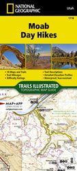
Moab Day Hikes (TI-1718)The Moab Day Hikes contains detailed maps for 18 of Moab's finest day hikes. It includes well-known hikes and some off-the-beaten-path trails. They range from easy strolls to strenuous climbs, selected to give you a sampling of all the region has to offer. Together, they cover...
- $14.95
- $14.95
- Unit price
- per
-
Panoramic Hiking Map: Yosemite National ParkThe Trail Tracks Panoramic Hiking Map of Yosemite National Park is your ultimate guide to exploring one of California's most iconic and breathtaking natural wonders. This map showcases the park's diverse landscapes, from the towering granite cliffs of El Capitan and Half Dome to...
- $12.95
- $12.95
- Unit price
- per
-
Red Cliffs Desert ReserveThe Red Cliffs Desert Reserve, located near St. George, Utah, is a stunning 69,000-acre protected area that offers a diverse range of trails and geographic features. The reserve is home to over 200 miles of non-motorized trails, making it a paradise for hikers, bikers,...
- from $9.95
- from $9.95
- Unit price
- per
-
Flagstaff, Sedona Map [Coconino and Kaibab National Forests] TI-856Explore Northern Arizona's pine forests, picturesque mountains, steep canyons, and red-rock buttes with National Geographic's Trails Illustrated map of Flagstaff & Sedona. Created in partnership with local land management agencies, this expertly researched map delivers unmatched detail and helpful information for experienced outdoor enthusiasts...
- $14.95
- $14.95
- Unit price
- per
-
US Geological Survey Glen Canyon Recreation Area MapIt's truly a delight to behold this magnificent 1969 U.S. Geological Survey map of the Glen Canyon National Recreation Area! This vintage cartographic masterpiece, a product of an era when paper maps were essential for exploration, offers a fascinating glimpse into the landscape of...
- $14.95
- $14.95
- Unit price
- per
-
Mogollon Rim, Munds Mountain: Apache-Sitgreaves, Coconino, and Tonto National Forests (TI-855)Explore Northern Arizona's pine forests, picturesque mountains, steep canyons, and red-rock buttes with National Geographic's Trails Illustrated map of Flagstaff & Sedona. Created in partnership with local land management agencies, this expertly researched map delivers unmatched detail and helpful information for experienced outdoor enthusiasts...
- $14.95
- $14.95
- Unit price
- per
-
Yellowstone National Park Day Hikes (TI-1705)• Waterproof • Tear-Resistant • Topographic Map Yellowstone is the wild heart of America! Established in 1872, it's our first National Park and the birthplace of the National Park idea. Its 2.2 million acres contain the world's largest, most varied collection of hydrothermal features...
- $14.95
- $14.95
- Unit price
- per
-
Southwest Colorado Trails Map"Southwest Colorado Trails Map" by Latitude 40 Maps is your gateway to unparalleled exploration across the diverse and breathtaking landscapes of southwestern Colorado. This meticulously crafted map unveils a vast network of trails, inviting adventurers to delve into a region rich in natural beauty...
- $14.95
- $14.95
- Unit price
- per
-
Fruita - Grand Junction Colorado Trails Map"Fruita - Grand Junction Colorado Trails" by Latitude 40 Maps is your ultimate guide to exploring the thrilling network of trails nestled amidst the stunning landscapes of western Colorado. This meticulously crafted map unveils a treasure trove of outdoor adventures, from flowing singletrack to...
- $14.95
- $14.95
- Unit price
- per
-
Green Trails Maps: Red Rock Canyon, NV (2474S)This spectacular area of red rock formations, sandstone mountains, and rugged desert canyons lies a mere 15 miles west of the Las Vegas Strip. Nearly 200,000 acres of this region is managed as the Red Rock Canyon National Conservation Area (NRCA) and is traversed...
- $20.00
- $20.00
- Unit price
- per
-
Crested Butte - Aspen - Gunnison Colorado Trails Map"Crested Butte - Aspen - Gunnison Colorado Trails" by Latitude 40 Maps is your gateway to exploring the breathtaking high-altitude trails nestled within the heart of Colorado's most iconic mountain destinations. This expertly crafted map unveils a vast network of adventures, from exhilarating singletrack...
- $11.95
- $11.95
- Unit price
- per
-
Sierra High Route - Traversing Timberline CountryBy Steve Roper Author conceived and pioneered the Sierra High Route Covers Kings Canyon National Park to northern Yosemite National Park Each route chapter includes points of interest, maps, approach instructions, and directions No ordinary guidebook, Sierra High Route leads you from point to point through...
- $24.95
- $24.95
- Unit price
- per

Local: 801-537-3320 Toll Free: 888-UTAHMAP (882-4627)
Hours: Monday–Friday 9 a.m. to 5 p.m.
-
-
- Recreation Books
- Adventure and Survival Books
- Hiking Books
- Outdoor Activities
- Fishing Maps & Books
- Rock Art and Scenic Books
- Nature Guide
-
Rockhounding, Geology and Mining
- Rockhounding, Geology and Mining
- Dinosaur and Fossil Books
- Geology Books
- Mineral Books
- Identification Field Guides
- Rockhounding Books
- Prospecting Books
- Mining Books
-
Navigation, First Aid and Knots
- Navigation, First Aid and Knots
- Knots Books
- First Aid Books
- Navigation Books
- Astronomy and Weather Books
-
- Geologic Publications
-
Economic Geology
- Economic Geology
- Engineering
- Minerals and Mining
- Uranium and Vanadium
- Coal Resources
- Fossil Energy
-
Minerals and Mining
- Minerals and Mining
- Gold
- Rocks, Minerals, and Fossils
- Mining
- Geologic Hazards
- Geothermal
- Great Salt Lake and Antelope Island
- Quaternary Studies and General Geology
- Paleontology and Paleoecology
- Stratigraphic Studies
- Water
- Public Interests
- Utah Geological Association
-
- Featured Maps and Books
- Exploring Southern Utah
- Utah Geological Survey - Survey Notes
-
- Deals
- Dino Deals
- Survival Books
Sidebar
Categories
- Maps
- Recreation Books
- Geologic Publications
- Discover More
- Featured Maps and Books
- Deals
Survey Notes


![Flagstaff, Sedona Map [Coconino and Kaibab National Forests] TI-856](http://utahmapstore.com/cdn/shop/files/TI00000856_0_LG_430x.jpg?v=1733178196)


Recently Viewed Products
Example product title
- $19.99
- $19.99
- Unit price
- / per
Example product title
- $19.99
- $19.99
- Unit price
- / per
Example product title
- $19.99
- $19.99
- Unit price
- / per
Example product title
- $19.99
- $19.99
- Unit price
- / per
Example product title
- $19.99
- $19.99
- Unit price
- / per
Example product title
- $19.99
- $19.99
- Unit price
- / per
Example product title
- $19.99
- $19.99
- Unit price
- / per
Example product title
- $19.99
- $19.99
- Unit price
- / per
Example product title
- $19.99
- $19.99
- Unit price
- / per
Example product title
- $19.99
- $19.99
- Unit price
- / per
- Choosing a selection results in a full page refresh.