-
Analysis of Septic-Tank Density for Rockville, Washington County, Utah (RI-288)by Trevor H. Schlossnagle and Torri Duncan Summary Rockville is a small rural town in southwestern Utah that is experiencing an increase in residential development. Because potential future septic-tank systems may overlie the principal drinking water aquifer for Rockville, city officials asked the Utah...
- $6.95
- $6.95
- Unit price
- per
-
Outcrop Chemostratigraphic Correlation of the Upper Green River Formations in the Uinta Basin, Utah (MP 13-1)Vendor: Utah Geological SurveyBy: Dave Keighley The Green River Formation of the Uinta Basin in eastern Utah is host to not only one of the world's largest oil shale deposits, primarily in the Mahogany oil shale zone, but it also contains significant conventional oil and gas reserves...
- $14.95
- $14.95
- Unit price
- per
-
Paleoseismology of Utah, Volume 23 - Compilation of U.S. Geological Survey National Earthquake Hazards Reduction Program Final Technical Reports for Utah (MP 13-3)Vendor: Utah Geological SurveyPaleoseismology of Utah, Volume 23 - Compilation of U.S. Geological Survey National Earthquake Hazards Reduction Program Final Technical Reports for Utah (MP 13-3) was compiled by Steve D. Bowman and William R. Lund. This publication serves as the twenty-third installment in the "Paleoseismology of...
- $14.95
- $14.95
- Unit price
- per
-
Hazus Loss Estimation Software Earthquake Model Revised Utah Fault Database (OFR-631)Vendor: Utah Geological SurveyBy: William R. Lund The Utah Geological Survey has revised and updated the Utah fault database used with the Federal Emergency Management Agency's Hazus Earthquake Model. The Hazus Earthquake Model loss estimation software is designed to produce loss estimates for use by federal, state,...
- $7.95
- $7.95
- Unit price
- per
-
Surface Fault Rupture Hazard Maps of the Levan and Fayette Segments of the Wasatch Fault Zone, Juab and Sanpete Counties, Utah (OFR-640)Vendor: Utah Geological SurveyBy: Adam I. Hiscock and Michael D. Hylland Contains plot files (PDF format) of surface-fault-rupture hazard maps of the Levan and Fayette segments (the two southernmost segments) of the Wasatch fault zone. The maps comprise seven 7.5-minute quadrangles (1:24,000 scale) that show potentially active...
- $14.95
- $14.95
- Unit price
- per
-
History of Late Holocene Earthquakes at the Willow Creek Site and on the Nephi Segment, Wasatch Fault Zone, Utah (SS-151)Vendor: Utah Geological SurveyBy: Anthony J. Crone, Stephen F. Personius, Christopher B. DuRoss, Michael N. Machette, and Shannon A. Mahan This 43-page report presents new data from the Willow Creek site that provides well-defined and narrow bounds on the times of the three youngest earthquakes on the...
- $14.95
- $14.95
- Unit price
- per
-
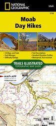
Moab Day Hikes (TI-1718)Vendor: National GeographicThe Moab Day Hikes contains detailed maps for 18 of Moab's finest day hikes. It includes well-known hikes and some off-the-beaten-path trails. They range from easy strolls to strenuous climbs, selected to give you a sampling of all the region has to offer. Together, they cover...
- $14.95
- $14.95
- Unit price
- per
-
Minerals Encyclopedia: 700 Minerals, Gems and RocksVendor: Firefly BooksMineral collecting by amateur "rockhounds" has never been more popular. Old quarries, road cuts, and exposed landscapes are being examined by new generations of minerals enthusiasts. Each needs a comprehensive guidebook with clear photographs and accurate data. This is it. In a thick but...
- $29.95
- $29.95
- Unit price
- per
-
Groundwater of Pahvant Valley, Millard County, Utah (SS-173)Vendor: Utah Geological SurveyBy: Greg Gavin, Paul Inkenbrandt, Trevor Schlossnagle, and Rebecca Molinar This comprehensive hydrogeologic assessment of Pahvant Valley's aquifer systems, conducted during 2022-2023, evaluated groundwater storage changes, recharge-discharge relationships, and anthropogenic impacts. The investigation integrated multiple analytical methods including potentiometric surface mapping, InSAR subsidence analysis,...
- $14.95
- $14.95
- Unit price
- per
-
Black Rock, Great Salt Lake Vintage PostcardPostcards from the Past. Discover a bygone era with this captivating historical postcard, "Black Rock, Great Salt Lake," a window into Utah's picturesque past. This isn't just a postcard; it's a tangible piece of history, produced between 1910 and 1930, transporting you to a...
- $1.00
- $1.00
- Unit price
- per
-
Capitol Reef Geological Cross SectionUnraveling Earth's Secrets: Capitol Reef Geological Cross Section Embark on a captivating journey through time with the Capitol Reef Geological Cross Section, a remarkable educational tool produced by the Capitol Reef Natural History Association. This meticulously crafted cross-section unveils the intricate layers of Earth's...
- $12.95
- $12.95
- Unit price
- per
-
Phragmites Mapping and Modeling in Great Salt Lake Wetlands at the Bear River Migratory Bird Refuge, Utah (RI-287)Vendor: Utah Geological Surveyby Peter Goodwin and Rebecca Molinari Phragmites threaten Great Salt Lake wetlands by readily displacing desirable native vegetation, degrading habitats, and diverting water from the lake and surrounding wetlands through increased evapotranspiration water loss. The Utah Geological Survey (UGS) developed this project with FFSL...
- $6.95
- $6.95
- Unit price
- per
-
Fault Trace Mapping and Surface-Fault-Rupture Special Study Zone Delineation of the East and West Cache Fault Zones and Other Regional Faults, Utah (RI-286)Vendor: Utah Geological Surveyby Adam I. Hiscock, Emily J. Kleber, Susanne U. Jänecke, Greg N. McDonald, Robert Q. Oaks Jr., and Tammy Rittenour This report presents detailed mapping of the East Cache fault zone (ECFZ), West Cache fault zone (WCFZ, Dayton-Oxford, Mantua area, and James Peak faults...
- $6.95
- $6.95
- Unit price
- per
-
Provisional Geologic Map of the Gold Hill Quadrangle, Tooele County, Utah (GIS Reproduction of UGS Map 140 [1993]) (M-301DR)Vendor: Utah Geological Surveyby James P. Robinson Summary The Gold Hill area of the northern Deep Creek Range near the Utah-Nevada border has undergone a diverse and complicated history of deposition, igneous activity, deformation, and mineralization and long attracted the attention of geologists. The Gold Hill mining...
- $17.95
- $17.95
- Unit price
- per
-
The Changing Bonneville Salt Flats (PI-106)Vendor: Utah Geological SurveyBy: Jeremiah Bernau The Bonneville Salt Flats in western Utah are renowned worldwide for hosting land-speed racing events. They are easily accessible from Interstate 80 and are managed by the Bureau of Land Management. This distinct landscape spans approximately 5 miles wide by 12 miles...
- $0.00
- $0.00
- Unit price
- per
-
Volcanoes: A folding Pocket Guide to Volcanos, Earthquakes, Hot Springs, Geysers & MoreVendor: National BookThis educational and entertaining pocket field guide provides a simplified introduction to the different types of volcanoes, lava flows, pyroclastic flows, and the rocks that are formed as a result of eruption. This guide will appeal equally to novice volcanologists and students of geology...
- $7.95
- $7.95
- Unit price
- per
-
A Directory of the Mining Industry of Utah 1967 (B-84)Vendor: Utah Geological SurveyThe first Directory of the Mining Industry of Utah published by the Utah Geological and Mineralogical Survey in 1965 covered the industry through the year 1964. This the second directory provides information through 1967. The following agencies were especially helpful in providing information for...
- $1.00
- $1.00
- Unit price
- per
-
Hydrogeologic Studies and Groundwater Monitoring in Snake Valley and Adjacent Hydrographic Areas, West-Central Utah and East-Central Nevada (B-135)Vendor: Utah Geological SurveyThis report presents results and analyses of hydrogeologic, geophysical, groundwater-monitoring, and hydrochemical studies and aquifer tests by the Utah Geological Survey (UGS) in Snake Valley, Tule Valley, and Fish Springs Flat, Millard and Juab Counties, west-central Utah. The primary objectives of this work were...
- $24.95
- $24.95
- Unit price
- per
-
Acadia National Park (TI-212)Vendor: National GeographicNational Geographic's Trails Illustrated map of Acadia National Park is designed to meet the needs of all visitors who wish to explore the islands and bodies of water of this national park. Expertly researched and created in partnership with the National Park Service and...
- $14.95
- $14.95
- Unit price
- per
-
Geology and Water Resources of the Spanish Valley Area, Grand and San Juan Counties, Utah (TP-32)Vendor: Utah Geological SurveyBy: C. T. Sumsion The Spanish Valley area covers about 144 square miles on the western slopes of the La Sal Mountains in southeastern Utah; within it, Spanish Valley comprises about 18 square miles. Altitudes of land surface within the area range from about...
- $9.95
- $9.95
- Unit price
- per

Local: 801-537-3320 Toll Free: 888-UTAHMAP (882-4627)
Hours: Monday–Friday 9 a.m. to 5 p.m.
-
-
- Recreation Books
- Adventure and Survival Books
- Hiking Books
- Outdoor Activities
- Fishing Maps & Books
- Rock Art and Scenic Books
- Nature Guide
-
Rockhounding, Geology and Mining
- Rockhounding, Geology and Mining
- Dinosaur and Fossil Books
- Geology Books
- Mineral Books
- Identification Field Guides
- Rockhounding Books
- Prospecting Books
- Mining Books
-
Navigation, First Aid and Knots
- Navigation, First Aid and Knots
- Knots Books
- First Aid Books
- Navigation Books
- Astronomy and Weather Books
-
- Geologic Publications
-
Economic Geology
- Economic Geology
- Engineering
- Minerals and Mining
- Uranium and Vanadium
- Coal Resources
- Fossil Energy
-
Minerals and Mining
- Minerals and Mining
- Gold
- Rocks, Minerals, and Fossils
- Mining
- Geologic Hazards
- Geothermal
- Great Salt Lake and Antelope Island
- Quaternary Studies and General Geology
- Paleontology and Paleoecology
- Stratigraphic Studies
- Water
- Public Interests
- Utah Geological Association
-
- Featured Maps and Books
- Exploring Southern Utah
- Utah Geological Survey - Survey Notes
Sidebar
Categories
- Maps
- Recreation Books
- Geologic Publications
- Discover More
- Featured Maps and Books
- Deals
Survey Notes


![Provisional Geologic Map of the Gold Hill Quadrangle, Tooele County, Utah (GIS Reproduction of UGS Map 140 [1993]) (M-301DR)](http://utahmapstore.com/cdn/shop/files/Gold_HILL_720x.jpg?v=1712616160)


Recently Viewed Products
- Choosing a selection results in a full page refresh.