-
Moon Arches & Canyonlands National Parks - Hiking, Biking, Scenic DrivesForge your own path through the rock arches, canyon-carving rivers, and ever-present ancient cultures of Southeastern Utah with Moon Arches & Canyonlands National Parks. Inside you’ll find: Flexible Itineraries: Unique and adventure-packed ideas for day trips to each park, road trips, and more The Best Hikes in Arches...
- $17.99
- $17.99
- Unit price
- per
-
Moon Utah: With Zion, Bryce Canyon, Arches, Capitol Reef & Canyonlands National ParksFrom remote deserts and arid mountain ranges to colorful canyons and world-famous national parks, Moon Utah reveals the best of this adventurous state. Inside you’ll find: Strategic itineraries, plus lists of the best scenic drives, hiking trails, breweries, and more How to plan a national parks road...
- $24.99
- $24.99
- Unit price
- per
-
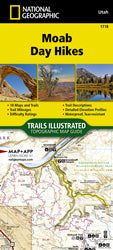
Moab Day Hikes (TI-1718)The Moab Day Hikes contains detailed maps for 18 of Moab's finest day hikes. It includes well-known hikes and some off-the-beaten-path trails. They range from easy strolls to strenuous climbs, selected to give you a sampling of all the region has to offer. Together, they cover...
- $14.95
- $14.95
- Unit price
- per
-
The Arches ReaderGeology is the star attraction in many national parks, but Arches National Park reveals erosional wonders like no other place on earth. There’s something thrilling and slightly unsettling about a massive rock with a hole in its middle or a ribbon of stone flung...
- $24.95
- $24.95
- Unit price
- per
-
Zion National Park Day Hikes (TI-1712)The Zion National Park Day Hikes Topographic Map Guide contains detailed maps for 15 of Zion's finest day hikes. It includes well-known hikes and some off-the-beaten-path trails. They range from easy strolls to strenuous climbs, selected to give you a sampling of all the park has to...
- $14.95
- $14.95
- Unit price
- per
-
Arapeen OHV Trail MapThe Arapeen OHV Trail System has hundreds of miles of trails and forest roads available for motorized use. The Manti-La Sal National Forest is an extraordinary destination for Off Highway Vehicle (OHV) enthusiasts. Most of the routes are open to OHV of all sizes,...
- $9.99
- $9.99
- Unit price
- per
-
Guide to Western National MonumentsBy Mike Endres Guide to Western National Monuments showcases 70 of the nation’s national monuments across the western United States. These are the best places to visit if you want to hike and camp in spectacular scenery with relatively few people (compared to national parks)....
- $26.95
- $26.95
- Unit price
- per
-
Moab East [Dewey Bridge, Sand Flats] (TI-507)National Geographic's Trails Illustrated map of the Moab Area East covers an exciting and rich area for exploration. A premier destination for mountain biking, hiking, whitewater rafting, four-wheeling, and more, Moab offers adventure and recreation in one of the most iconic landscapes in the...
- $14.95
- $14.95
- Unit price
- per
-
Moab Area West [Klondike Bluffs, Dead Horse Point] (TI-506)National Geographic's Trails Illustrated map of the Moab West area provides details of roads and trails. A premier destination for mountain biking, hiking, whitewater rafting, four-wheeling, and more, Moab offers adventure and recreation in one of the most iconic landscapes in the United States....
- $14.95
- $14.95
- Unit price
- per
-
Moab Greater Region (TI-505)National Geographic's Trails Illustrated maps of Moab were created in partnership with local land management agencies and adventure experts to provide unmatched detail of the area, with useful up-to-date information to guide and enrich your visit. A premier destination for mountain biking, hiking, whitewater...
- $14.95
- $14.95
- Unit price
- per
-
Desert Rock: Rock Climbs in the National ParksA Rock climbing guide with routes in Arches, Zion, Capitol Reef and Canyonlands National Parks. Includes Glen Canyon National Recreational Area and Green River area just outside the park boundary of Canyonlands National Park.
- $25.00
- $25.00
- Unit price
- per
-
Arches and Canyonlands National Parks: In the Land of Standing RocksIn this latest installment of Falcon Guides’ Adventures with the Parkers series, the Parkers, an intrepid family of four, journey to southeast Utah to see the “Land of Standing Rocks” and such prominent features as Delicate Arch, Landscape Arch, Park Avenue Skyline, the Needles, and much...
- $12.95
- $12.95
- Unit price
- per
-
50 Best Short Hikes: Utah's National ParksDramatic arches, natural bridges, soaring cliffs, balancing rocks, mysterious hoodoos, and slot canyons―Utah is famous for the unparalleled beauty of its five national parks. There’s so much to take in, and you want to see the best of it all. Make the most of...
- $21.95
- $21.95
- Unit price
- per
-
Best Easy Day Hikes: Capitol Reef National ParkBest Easy Day Hikes Capitol Reef National Park features the best easy day hikes throughout the park. With detailed maps and trail descriptions, navigating these wonderful trails is made easy. It’s the perfect tool for day hikers, families, and local outdoors people looking to...
- $12.95
- $12.95
- Unit price
- per
-
Capitol Reef National Park: The Complete Hiking & Touring GuideFully experience Capitol Reef National Park and it's stunning landscape on foot or from the road with this comprehensive guide! Inside you will find: Covers: Hikes from the casual to the difficult; Canyoneering routes and tips; Overnight treks; Scenic drives on paved and dirt...
- $24.00
$12.00- $24.00
- Unit price
- per
-
The Capitol Reef ReaderFor 12,000 years, people have left a rich record of their experiences in Utah’s Capitol Reef National Park. In The Capitol Reef Reader, award-winning author and photographer Stephen Trimble collects the best of this writing—160 years worth of words that capture the spirit of the park...
- $19.95
- $19.95
- Unit price
- per
-
Arches to Zion: A Guide to the Scenery and Geology of the Colorado Plateau Between Utah's National ParksThe geological scenery that brings Visitors to Utah's five national parks does not start and stop at the park boundaries. This richly illustrated book provides interested travelers with mile-by-mile insights into the geological and human history of the area between Utah's world-famous national parks....
- $15.00
- $15.00
- Unit price
- per
-
Hiking Southwest Canyon Countryby Sandra Hinchman Visit pueblo ruins, admire striking arches, stroll through impressive river canyons, soak in rock art, take a backpacking trip, and more. From national parks (Zion, Bryce Canyon, Arches, Canyonlands, Grand Canyon, Mesa Verde, and Petrified Forest, Capitol Reef) to national monuments...
- $24.95
- $24.95
- Unit price
- per
-
Exploring Utah's Bears Ears and Cedar Mesa - A Guide to Hiking, Backpacking, Scenic Drives, and LandmarksExplore Bears Ears and Cedar Mesa is a comprehensive guide to 25 of the best destinations within one of America’s newest national monuments. Whether you’re a hiker or backpacker looking for the route that makes the most of the land’s natural beauty, or a day-tripper...
- $24.95
- $24.95
- Unit price
- per
-
Mountain Biking MoabMountain Biking Moab: More than 40 of the Area's Greatest Off-Road Bicycle Rides. By: David Crowell The Mountain Biking Moab Pocket Guide gives fat-tire enthusiasts the skinny on where to ride in this southwestern Mecca for mountain biking. The best rides around Moab, in Canyonlands and...
- $19.95
- $19.95
- Unit price
- per

Local: 801-537-3320 Toll Free: 888-UTAHMAP (882-4627)
Hours: Monday–Friday 9 a.m. to 5 p.m.
-
-
- Recreation Books
- Adventure and Survival Books
- Hiking Books
- Outdoor Activities
- Fishing Maps & Books
- Rock Art and Scenic Books
- Nature Guide
-
Rockhounding, Geology and Mining
- Rockhounding, Geology and Mining
- Dinosaur and Fossil Books
- Geology Books
- Mineral Books
- Identification Field Guides
- Rockhounding Books
- Prospecting Books
- Mining Books
-
Navigation, First Aid and Knots
- Navigation, First Aid and Knots
- Knots Books
- First Aid Books
- Navigation Books
- Astronomy and Weather Books
-
- Geologic Publications
-
Economic Geology
- Economic Geology
- Engineering
- Minerals and Mining
- Uranium and Vanadium
- Coal Resources
- Fossil Energy
-
Minerals and Mining
- Minerals and Mining
- Gold
- Rocks, Minerals, and Fossils
- Mining
- Geologic Hazards
- Geothermal
- Great Salt Lake and Antelope Island
- Quaternary Studies and General Geology
- Paleontology and Paleoecology
- Stratigraphic Studies
- Water
- Public Interests
- Utah Geological Association
-
- Featured Maps and Books
- Exploring Southern Utah
- Utah Geological Survey - Survey Notes
-
- Deals
- Dino Deals
- Survival Books
Sidebar
Categories
- Maps
- Recreation Books
- Geologic Publications
- Discover More
- Featured Maps and Books
- Deals
Survey Notes


![Moab East [Dewey Bridge, Sand Flats] (TI-507)](http://utahmapstore.com/cdn/shop/products/TI00000507_0_MD_220x.jpg?v=1647033185)
![Moab Area West [Klondike Bluffs, Dead Horse Point] (TI-506)](http://utahmapstore.com/cdn/shop/products/TI00000506_0_LG_430x.jpg?v=1647033033)


Recently Viewed Products
Example product title
- $19.99
- $19.99
- Unit price
- / per
Example product title
- $19.99
- $19.99
- Unit price
- / per
Example product title
- $19.99
- $19.99
- Unit price
- / per
Example product title
- $19.99
- $19.99
- Unit price
- / per
Example product title
- $19.99
- $19.99
- Unit price
- / per
Example product title
- $19.99
- $19.99
- Unit price
- / per
Example product title
- $19.99
- $19.99
- Unit price
- / per
Example product title
- $19.99
- $19.99
- Unit price
- / per
Example product title
- $19.99
- $19.99
- Unit price
- / per
Example product title
- $19.99
- $19.99
- Unit price
- / per
- Choosing a selection results in a full page refresh.