


Ground-water resources and simulated effects of withdrawals in the East Shore area of Great Salt Lake, Utah (TP-93)
By: David W. Clark, Cynthia L. Appel, Patrick M. Lambert, and Robert L. Puryear
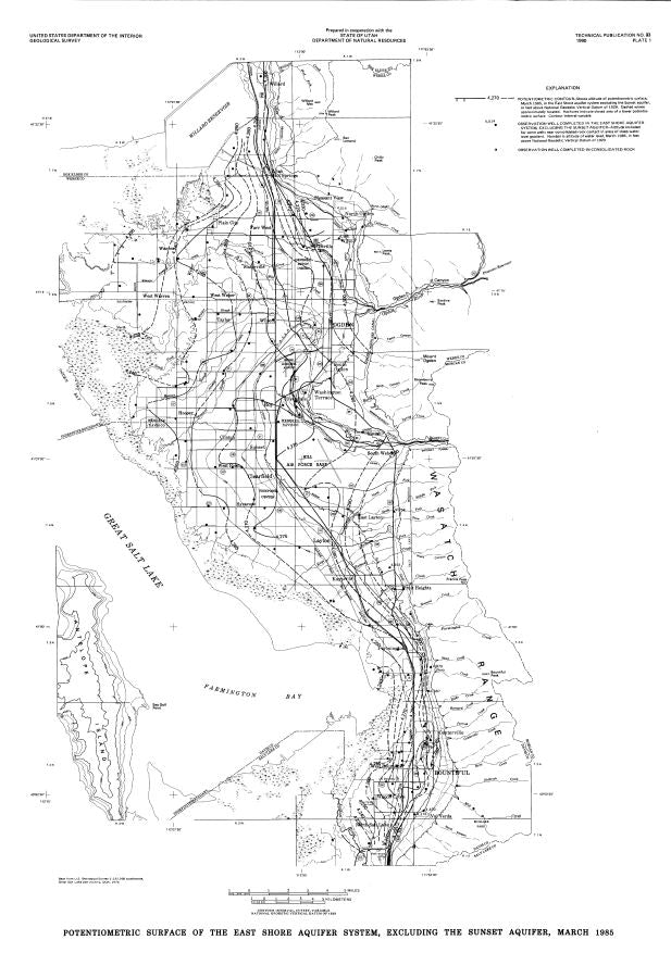
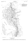
The ground-water resources in the East Shore area of Great Salt Lake, Utah, were studied to better define the ground-water system; to document changes in ground-water levels, quality, and storage; and to simulate effects of an increase in ground-water withdrawals. The East Shore aquifer system is in basin-fill deposits, and is primarily a confined system with unconfined parts near the mountain front.
Recharge to and discharge from the East Shore aquifer system were estimated to average about 160,000 acre-feet per year during 1969-84, with minor amounts of water being removed from storage during that period. Major sources of ground-water recharge are seepage from surface water in natural channels and irrigation canals, and subsurface inflow from consolidated rock to the basin-fill deposits. Discharge of ground water is primarily to wells, water courses, springs, and as diffuse seepage to Great Salt Lake. Average annual surface-water inflow to the study area was estimated to be 860,000 acre-feet for the period 1969-84. Annual withdrawal of ground water for municipal and industrial use increased from about 10,000 acre-feet in 1960 to more than 30,000 acre-feet in 1980 to supply a population that increased from 175,000 in 1960 to 290,000 in 1980.
Long-term trends of ground-water levels indicate a steady decline at most observation wells since 1952, despite near normal or increased precipitation since the late 1960's. Water levels declined as much as 50 feet near the principal pumping center in the east-central part of the study area. They declined as much as 35 feet more than five miles from the pumping center. The increase in withdrawals and subsequent water-level declines have caused about 700 wells within 30 square miles to cease flowing since 1954.
A numerical model of the East Shore aquifer system in the Weber Delta area was constructed and calibrated using water-level data and changes in ground-water withdrawals for 1955-85. Predictive simulations were made based on doubling the 1980-84 rate of municipal and industrial withdrawals for 20 years, and using both average and below-average recharge rates. The simulations indicated water-level declines of an additional 35 to 50 feet near the principal pumping center; a decrease in natural discharge to drains, evapotranspiration, and Great Salt Lake; and a decrease in ground-water storage of 80,000 to 115,000 acre-feet after 20 years.
Additional Information:
Published: 1990Pages: 160
Location: East Shore, Great Salt Lake, Utah
Media: Printed report and map