


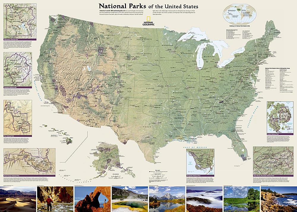
National Parks of the United States Wall Map
Separate inset maps provide detail and descriptions of seven of the parks: Yellowstone, Yosemite, Acadia, Grand Canyon, Great Smoky Mountains, Everglades, and Zion. Parks located in U.S. territories are included on an inset world map.
Includes insets of the Yellowstone, Yosemite, Acadia, Grand Canyon, Great Smoky Mountains, Everglades, and Zion National Parks, an inset world map showing outlying U.S. National Parks, a list of parks near metropolitan areas.
Popular Places Included on the Map include Yellowstone, Yosemite, Denali, Joshua Tree, Acadia, Grand Canyon, Great Smoky Mountains, Hawai'i Volcanoes, Everglades, Zion, Mount Rushmore, Great Sand Dune, and Rocky Mountain national parks.
The map is packaged in a two inch diameter tube with a label showing a thumbnail of the map with dimensions and other pertinent information.
Other Information:
Flat Size: 42" x 30"
Scale: 1:5,183,000
Copyright Date: 2022